
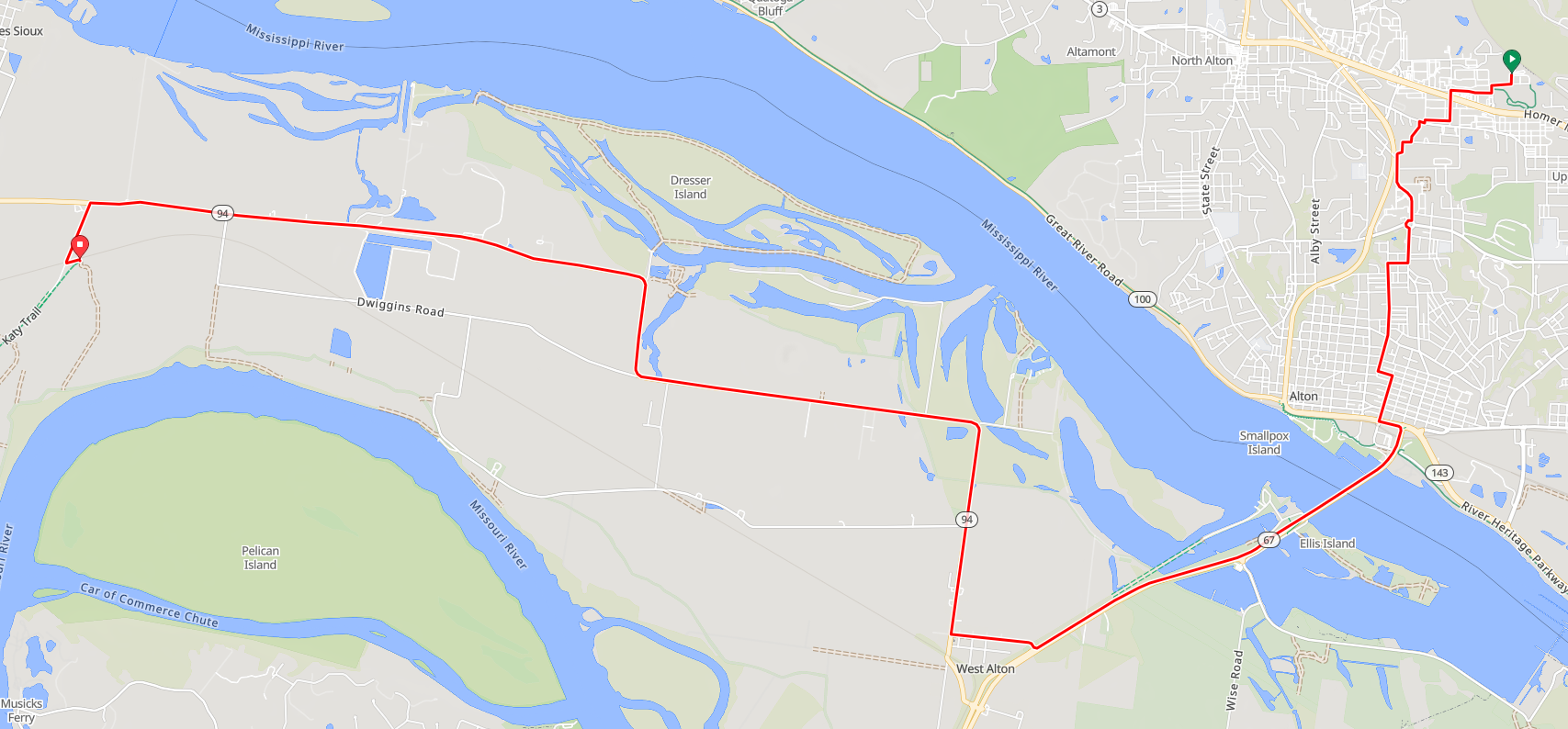
Alton Amtrak to Machens
This road cycling route goes from the Amtrak station in Alton, Illinois to the Machens trailhead of the Katy Trail. If you are looking for the reverse route, it is here: Machens to Alton Amtrak.
There are other Katy-Amtrak options in the St. Louis area, most of which are longer.
Courses/Routes for GPS Bicycle Computers
Ride with GPS:
Alton Amtrak to Machens
Garmin:
Alton Amtrak to Machens
Strava:
Alton Amtrak to Machens
15.19 miles, 170 feet ascent
Good Old-Fashioned Directions
- From the Amtrak station in Alton, Illinois, turn right (west) onto Golf Road.
- Turn left (south) to continue on Golf Road.
- Take the next right (west) on Baron Commerce Parkway.
- Turn left (south) onto Buckmaster Lane. At the traffic light, ride straight across IL-3.
- Turn right (west) at Oakwood Road.
- Turn left (south) on Toledo Avenue.
- Turn right (west) onto Tonsor Rd. The road becomes Central Avenue. At the traffic circle, ride to the far side of the circle to continue on Central Avenue.
- Turn right (west) onto Grove Street.
- Turn left (south) onto Liberty Street. Ride for 0.7 miles.
- Turn left (east) at 6th Street.
- Turn right (south) onto Ridge Street.
- Turn left (east) with the traffic light at US-67 (Landmarks Blvd).
- Turn right (south) onto the ramp for the Clark Bridge. Take the bike lane. Follow US-67 for 2.8 miles.
- Turn right (west) onto St. Charles Street.
- Turn right (north) onto MO-94. Follow M-94 for 7.8 miles.
- Turn left (south) onto Machens Road. Follow this for 0.6 miles.
- Turn left after the tracks onto the gravel road. In 500 feet, the end of the Katy Trail will be on the right.
- Turn right onto the Katy Trail.